Move through the work.
Pinch to zoom, drag to pan, or use the zoom and Fit controls. Horizontal zoom and vertical exaggeration are disclosed, so the displayed shape has a clear scale context.

Fullscreen profiles & engineering exports
Open your leveling work in a fullscreen profile. Inspect the distance, height difference and gradient together, then carry the saved survey context into PDF, Excel and CSV reports.
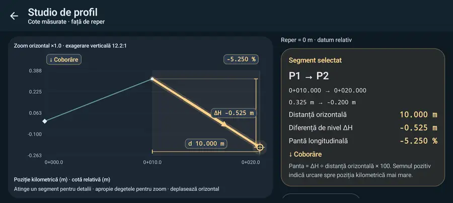
Give the profile its own inspection window, in portrait or landscape. Tap a segment or use Previous/Next to follow the alignment; its exact endpoints, horizontal distance, signed ΔH and slope stay in view.
Pinch to zoom, drag to pan, or use the zoom and Fit controls. Horizontal zoom and vertical exaggeration are disclosed, so the displayed shape has a clear scale context.
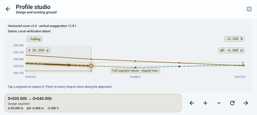
Inspect measured or relative-target profiles. In the design view, switch Design and Existing ground layers independently and review ground-minus-design at the selected station.
Direction arrows and signed dimensions explain rising, falling and level segments. View controls change the inspection window; original observations and station coordinates remain intact.
In Reports and exports, choose the saved project sources by name and select the document language independently. The profile becomes a drawing and a numeric schedule you can inspect and share.
Landscape A4 profiles include source and datum context, physical axis scales, numeric chainage, station drop lines and aligned ordinate, distance and grade bands. Dense profiles continue across bounded station windows.
Native XY charts retain numeric chainages and unequal station spacing. Separate drawing sheets and source tables preserve coordinates and original interval schedules, with explicit chart bounds and print areas.
Export profile coordinates and original per-series intervals, including distances, signed height differences and gradients. Choose comma, semicolon or tab conventions for the next step in your workflow.
Reports capture saved work. Refresh or regenerate after edits; use project backups to transfer or restore complete projects.
Keep backsights, intermediate sights, foresights and turning points, with independent HI/rise-fall and closure checks. Set out heights or measure from a known HI or reference reading. Unknown reference elevation stays relative. Readings use mm; elevations and distances use m.
In development · 0.6.4 · Android 8.0+. Discuss a field workflow